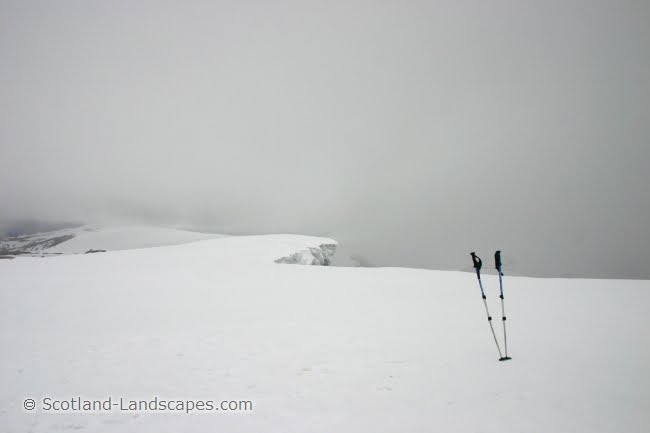
I had a busy March and April spending some quality time out in Sutherland and the Cairngorms whilst watching the lovely snow recede rapidly in the ludicrously mild conditions, a big let down after the prolonged snow of 2010.
Its taken a while to sort through all the photos and come up with a coherent post (hopefully a Cairngorms one to follow as well). This one details 3 good Sutherland hill routes and tracks the onset of the mild spring weather.
On the 12th March the snow began to fall on the Cairngorms and surrounding areas. It initially came on a gentle southerly air flow, following preceding days of very strong westerly winds that had blown exposed slopes and ridges clear and led to accumulations on eastern slopes. The new snow quickly accumulated leading to the closure of the Cairngorm ski road and centre for a time.

By the end of the 13th and into the 14th heavy precipitation falling as snow over northern hills, fell after winds turned north easterly and strengthened. This soon gave way to a south westerly airflow rotating around the northern edge of a high pressure system situated over southern England and France. Its this high pressure systems presence for much of the time since that has led to the mild temperatures, much to my disappointment!
Ben Klibreck Ski Tour - 18th & 19th March 2011


 Evening rays of sun over Loch Naver a week later on the 25th March after a week of mild temperatures and rapid melting
Stac Pollaidh Scramble & Ben More Assynt Ski - 2nd & 3rd April 2011


Its taken a while to sort through all the photos and come up with a coherent post (hopefully a Cairngorms one to follow as well). This one details 3 good Sutherland hill routes and tracks the onset of the mild spring weather.
On the 12th March the snow began to fall on the Cairngorms and surrounding areas. It initially came on a gentle southerly air flow, following preceding days of very strong westerly winds that had blown exposed slopes and ridges clear and led to accumulations on eastern slopes. The new snow quickly accumulated leading to the closure of the Cairngorm ski road and centre for a time.

Sunday 13th March 2011 in Tomatin. 45cm of snow had accumulated in the previous 20 hours
By the end of the 13th and into the 14th heavy precipitation falling as snow over northern hills, fell after winds turned north easterly and strengthened. This soon gave way to a south westerly airflow rotating around the northern edge of a high pressure system situated over southern England and France. Its this high pressure systems presence for much of the time since that has led to the mild temperatures, much to my disappointment!
Ben Klibreck Ski Tour - 18th & 19th March 2011

Ben Griam Mor in the sun through a snow shower on a Friday evening after work en route to Klibreck

A full moon providing beautiful light over Ben Klibreck and the Altnaharra area

A stunning sunrise over Sutherland too. Ben Griam Mor is to the left and Morvern's shapely summit is peaking over the skyline on the right, from near the east coast
Interactive map of the ski route on Ben Klibreck
Interactive map of the ski route on Ben Klibreck
There are more direct routes to Meall nan Con but traversing the undulating ridge from the west gives a good ski tour in the right conditions. After a good snow fall its quite often possible to ski from and to the roadside.

Ben Klibreck from Cnoc Sgriodain
There was plenty of snow on northerly, easterly and south westerly aspects but also bare aspects blown clear by strong winds discussed above.

Meall nan Con, the summit cone of Ben Klibreck from the south west. Ben Loyal in the distance to the left
The summit cone of Meall nan Con is fairly steep and regularly holds good snow providing a remote and exhilarating ski.

A proud stag on the lowest slopes of Ben Hope in Strathmore on the afternoon of the 19th March

Shaggy highland cattle further north along Strathmore
Ben Griam Mor - 25th March
 Evening rays of sun over Loch Naver a week later on the 25th March after a week of mild temperatures and rapid melting
Stac Pollaidh Scramble & Ben More Assynt Ski - 2nd & 3rd April 2011

Spring in full swing on Stac Pollaidh
A scramble up the east ridge (on the right), along the summit ridge and down a gully near the western end of the hill, was an afternoon jaunt on the 2nd April.

A sepia view along the summit ridge of Stac Pollaidh with the spectacular weathered Torridonian Sandstone pinnacles of the south face on the left

The Summer Isles highlighted in the sun from the summit of Stac Pollaidh

Cul Mor (left) and Suilven (right) from the shores of Loch Borralan early on the morning of the 3rd April
Interactive map of the route on Ben More Assynt
The easterly approach to Ben More Assynt is fairly lengthy and I don't get the impression that the estate is geared up for walkers. Once the track climbs out of the Glen the going is actually along good tracks which allow rapid coverage of the distance, but unfortunately the upper Glen Cassley is blighted by a massive pipeline and ageing hydroelectric works which tie in to the Loch Shin hydro scheme.

A blight on the landscape
According to Renewable Energy in Scotland - Wikipedia 1.3 Giga Watts of electricity is supplied by hydro electric schemes in Scotland, around 13% of the countries generating capacity. In comparison Hunterston B & Torness nuclear power stations in southern Scotland produce a total of around 2.4 GW (Wikipedia - Nuclear power in the UK). Anyone who has explored the Scottish Highlands extensively will know that many, many glens have been ravaged by unsightly pipelines, dams and other concrete structures to produce the 1.3GW, not to mention the number of glens obliterated by flooding, and the human misery and upheaval associated with this and the original construction works (much of it in the 1950's). It just does not make sense to blight large tracts of land like this for comparatively small amounts of energy production when small areas of current industrial sites can be developed for new nuclear power or modern cleaner gas or coal power stations. The landscape of the Highlands, and Scotland in general, is its greatest asset, and the Scottish Governments current energy policy is driving us headlong into ravaging massive tracts of land with ugly, noisy, environmentally disastrous, ineffective and expensive wind turbines, and the tracks and infrastructure that go with them across the hills. The only benefit of these is to the land owners who give over "their" land to it.
Back to the beauty......

The summit of Ben More Assynt - the last remnants of winter in Sutherland

A nice ski down from the ridge between Ben More Assynt and its south top
I'm no extreme skier and the top section off the ridge was a touch steep for me so I scrambled down the centre rocks till the angle became a little more forgiving. My turns can be made out in the centre before I traversed down to the left of the picture. In hindsight I should have just taken on the steep gully from the ridge and gained that extra satisfaction afterwards.

Back to Ben More Assynt across the bog

Ben Klibreck on the afternoon of 3rd April 2011. A big change in 2 weeks
Conival South Ridge Scramble - 22nd April 2011
Interactive map of the route on Conival

Primroses in the sun - a definite sign of spring

The south ridge of Conival (right)
The south ridge of Conival is a grade 2 scramble according to Highland Scrambles North but unless the trickiest lines are sought out on the lower blocks I think this might be too high. Certainly, I don't believe the unavoidable sections on the upper ridge warrant more than a grade 1. Its an entertaining alternative to the standard route on the hill though, with an interesting approach up Gleann Dubh and the River Traligill and through the bealach between Conival and Breabag. The geology of this area is tremendous being situated in the "Assynt Window" of the Moine Thrust Zone.

Last snows - Ben More Assynt from Conival

Evening sun over Loch Assynt and Quinag

Sunset over Loch Assynt and Quinag from the slopes of Beinn an Fhurain above Gleann Dubh
See more photos at Scotland-Landscapes.com
Prints of selected Scotland-Landscapes photos are available to buy online at Photobox.
Jason Bonniface, 09/05/2011
© Scotland-Landscapes.com